Reeves County. In 1883 the northwest portion of Pecos County, including an area of 2,721 square miles, or three times the size of an ordinary county, was set off under the name of Reeves County. A county government was organized in 1884. In 1880 Pecos County, an immense region bounded on the south by the Rio Grande and on the east and north by the Pecos River, had a population of 1,807, three-fourths of whom were Mexicans, and at that time old Fort Stockton was the county seat. During 1881 the Texas & Pacific Railroad was built across the northern part of old Pecos County, and the Southern Pacific across the southern part. Settlement began along the Texas & Pacific, merchants and mechanics and farmers locating here in the midst of what had for some years been occupied solely by stockmen. It was as a result of this settlement that the new county of Reeves was formed. In 1899 the Pecos River Railroad was built north from Pecos City to the New Mexico line, and that road opened up to settlement and development the Valley of the Pecos for many miles. Within the last decade the enterprise of citizens at Pecos City and along the Toyah Valley have constructed a home road known as the Pecos Valley Southern, a distance of forty-one miles and furnishing transportation facilities to the rich and rapidly developing irrigation district along the Toyah Creek.
The population of Reeves County in 1890 was 1,247 ; in 1900, 1,847 : in 1910, 4,392, including about 800 Mexicans. The principal city and the county seat is Pecos City, whose population in 1890 was 393 ; in 1900, 639; in 1910, 1,856, and in 1920, 1,587. The town of Toyah, on the line of the Texas & Pacific, had a population in 1910 of 1,052 and 771 in 1920.
Reeves County lies in the dry farming and irrigation region of West Texas. The Pecos River forms the entire northeast border of the county, while at right angles and flowing centrally through the southern part of the county is Toyah Creek, the water course of the now noted Toyah Valley. In these valleys during recent years have been under taken some large projects of irrigation development, besides a large amount of individual farming and stock raising.
The surface of the county is generally level and a large part of the soil is the washings from the mountains, and exceedingly rich. During the last few years considerable acreage has been placed under irrigation in the vicinity of the Pecos River, in the shallow water belt near Pecos City and at Balmorhea and Saragosa, at the foot of the Davis Mountains, where several springs are located. In 1913 it was estimated that about twenty thousand acres were irrigated in the different parts of the county, and alfalfa, cotton, fruits and vegetables, and the usual Texas staples, are all products which have helped to make the Pecos country famous. It is claimed that the grapes and melons raised in this section are the equal if not superior to the California fruits, and the horticulture and truck industry is being established on a commercial basis. Among other resources of the county should be mentioned the Toyah shallow oil fields. A shallow sand struck at 657 feet north of Pecos started a development program in which more than fifty rigs were erected in 1920.
The total area of Reeves County is 1,779,840 acres, and the last census reported 563,033 acres included in farms, while about 16,000 acres were "improved land," as compared with 8.000 acres in 1900. The number of farms or ranches increased from sixty-three in 1900 to 225 in 1910. Nearly all the cultivated land is irrigated, and the amount under irrigation in 1909 was 14,000 acres, divided among sixty-three irrigated farms. In 1909 the chief crops were hay and forage crops. kafir corn and milo maize. The assessment values in Reeves County in 1903 aggregated $1,342,989'; in 1909, $7,065,548 ; in 1913, $8,593,312 ; in 1920, $8,286,344.
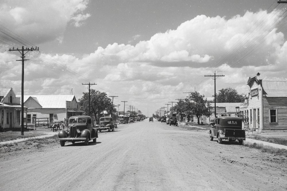
Pecos City, the county seat, was founded about the latter part of the year 1881. when the railroad was completed. The town was at first located near Pecos River, about a mile and a half east of the present site, to which the town was removed in 1885. It has been the county seat since the organization in 1884. Perhaps the chief charm of the city is its residence section, beautiful home-like places surrounded by pretty lawns and embowered among the cypress-cedar trees which have been imported from California and flourish in this vicinity.
The altitude is about twenty-six hundred feet, and the climate is one of the valuable assets. Artesian wells are found in all parts of the town, and there is a water works plant for the business district, which is not needed in the residential section. A sewer system reaches all sections of the town.
Other public utilities include electric lights and an ice plant. Commercially Pecos City has for years been the business center for a large section of West Texas, and several of the mercantile firms transact a business that is larger in the aggregate than similar establishments in the large cities of the state. - History of Texas, 1922, by W. Barrett Travis.
31° 25' 22.476" N, 103° 29' 35.628" W
See map: Google Maps, Yahoo! Maps, MapQuest