Crosbyton, county seat of Crosby County, is on U.S. Highway 82 on the Llano Estacado a few miles west of Blanco Canyon and thirty-six miles east of Lubbock.
City of Crosbyton. Founded 1908 on ´Cutting Grounds´ of C.B. Livestock Company which built a school, Supply Store, Railroad and Inn to encourage settlers. By 1911, had 1,000 citizens, was county seat. Today is center of Rich Irrigated Farm Land. Home of Pioneer Museum. Gateway to White River Dam. - Historical Marker Text. Marker erected 1966.
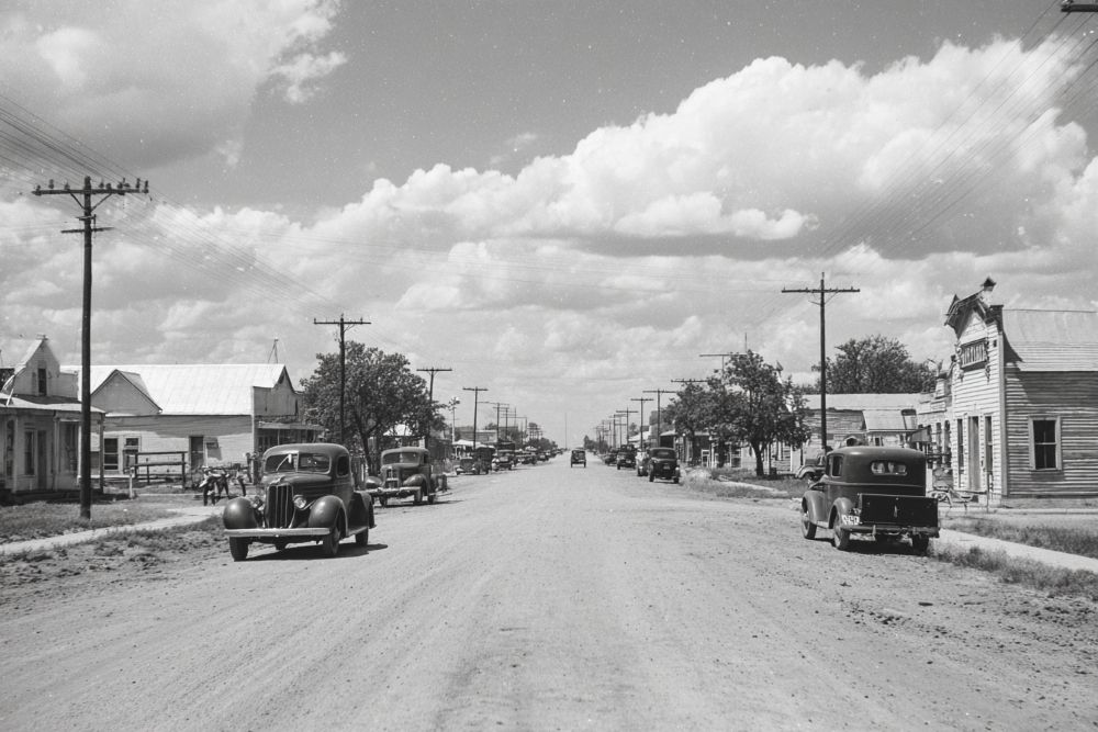
Crosbyton was named for General Land Office commissioner Stephen Crosby, and lies in the center of a productive dairying and farming area. This territory was still cattle country when, in 1902, the C. B. Livestock Company purchased 90,000 acres from the Kentucky Cattle Company. By 1912 a 10,000-acre demonstration farm was under the C. B.'s supervision, with Judge L. Gough serving as farm manager. From about 1907 to 1915 the company engaged in land sales, promoting the area as a great cotton-growing region, and thereby aiding the growth of Crosbyton. In January 1908 the C. B. Livestock Company surveyed a townsite, and in February Crosbyton was opened and town lots were sold. Another opening sale took place in June of that year, and the next month the Crosbyton post office was established, with Julian M. Bassett as postmaster. The Crosbyton Inn, a three-story hotel that became noted for its hospitality, was also constructed in 1908. On September 17, 1910, Crosbyton won, by a vote of 198 to 120, a county-seat election over Emma, and after a court fight Crosbyton became the county seat. A few months later, on April 10, 1911, the first train left on the Crosbyton-South Plains Railroad. From the period of World War I through the 1920s the population of Crosbyton and Crosby County grew steadily.
Citizens National Bank. Site of Crosbyton's first bank. In 1909, First State Bank (soon named First National) opened in a new two-story concrete block and stone building, erected by C. B. Livestock Company. For bank, office use. In 1917, Citizens National Bank (est. 1905) purchased the property upon its move here from Emma, then county seat. December 14, 1929, the two banks merged. A new bank building was erected over the original basement and part of the old foundation in 1952. Present stockholders and directors are: R. A. Jefferies, Russell McCurdy, John Hughes, Leslie Mitchell, James C. Reed, John Brown. - Historical Marker Text. Marker erected 1965. Marker located at the corner of First and Berkshire Streets, Crosbyton.
Lamar Building. Site of Crosbyton Inn, first hotel here, built 1908, by C. B. Livestock Company to help promote area for cotton farming. A two-story frame building, it was mecca for travelers and land buyers. After fire in 1912, hotel rebuilt over original basement. It was razed in 1920s. A brick office and apartment building was erected by E. H. Hendricks in 1926; purchased 1944 by W. P. Lamar and renamed Lamar Building. Lamar (1889-1946), farmer, businessman, was son of pioneer of Crosby County. - Historical Marker Text. Marker ereced 1967. Located on Lowrie Drug Store, First Hotel, Crosbyton.
Crosbyton Cemetery. Established in 1909, this cemetery was once part of a 90,000-acre ranch operated by the C. B. Livestock Company. Julian Bassett, part owner of the company and donor of the Crosbyton townsite, also gave the land for this burial ground when James Boggs, a cowboy on the ranch, was ill and was thought to be dying. The first burial was that of 18-month-old Willie Oliver. Others interred here include Julian Bassett and many other early settlers who were influential in the development of the area. The Crosbyton Cemetery is a reminder of the region's pioneer heritage. - Historical Marker Text. Marker erected 1984.
Main Supply Camp on Historic Mackenzie Trail. Trail followed by Gen. Ranald Mackenzie, U.S. 4th Cavalry in 1871 frontier campaign. He camped at Dewey Lake after brush with Indians. In 1872, he was again ordered to ferret out the Comanches. From his main supply camp on Brazos River Freshwater Fork (now White River), he launched a drive against Quanah Parker. Ended with fights in Palo Duro and Tule Canyons, last battles between Indians and Cavalry in this area; opened the Plains to white settlement. - Historical Marker Text. Marker erected 1967. Location: From Crosbyton, take US 82 about 4 miles East.
McNeill Ranch. In 1882 James Calvin McNeill (b. 1844), Brazoria County rancher, purchased 8,000 acres in Crosby County to expand his cattle business. Maintaining two distant ranches became difficult, so in 1890 George M. Williamson, his cousin, came to assist in the management of this property, later expanded to 18,240 acres. In 1902 James Calvin McNeill, Jr. (1875-1949) took over operation of the ranch. The elder McNeill divided his property among his children in 1930. For one hundred years the McNeill ranch has played a significant role in the ranching history of this area. - Historical Marker Text. Marker erected 1982. Location: At ranch Headquarters, from Crosbyton, take US 82 about 12 miles East to Intersection of US 82 with FM 836 then follow FM 836 about 2 miles South, then right onto McNeill Ranch Road.
Texas Ranger Campsite. Law and order for plains area began here in 1879 with creation of Camp Roberts, first ranger station in Panhandle. Company C of the newly formed Frontier Battalion of Texas Rangers was located here and commanded by Captain G. W. Arrington, Civil War veteran, hard-fighting Ranger, later a Panhandle sheriff and rancher. Battalion commander was Maj. John B. Jones. Frontier Battalion was created to protect settlers from marauding Indians and outlaws; rowdy cowboys also needed disciplining. Captain Arrington's C Company was to have 75 men to meet these duties--he never had more than 28. A large territory and few men to cover it meant scouting parties always on the move. Living conditions on the vast, arid plains, scouting trips, encounters with violence, long watches over dangerous captives made a Ranger's life hard. Each man was self-supporting, furnishing his own saddle, ropes, guns, clothing, horse, bedding; he received small salary, ammunition and food from the state. Shooting matches provided much of his off-duty entertainment. By 1881 local Indian menace was removed; Rangers went to new frontier, 1882. Remnants of Camp Roberts today are foundations of three sod buildings around an old well used by the Rangers. - Historical Marker Text. Marker erected 1967. Location: From Crosbyton, take US 82 about 4 miles East.
Crosbyton, TX 33° 39' 36.306" N, 101° 14' 16.5408" W
See map: Google Maps, Yahoo! Maps, MapQuest